
EXPLORE THE SOUTHWEST
Two-Week Southwest United States Road Trip Itinerary
There’s nothing like the American Southwest—vast landscapes, intricate rock formations, star-studded night skies, plenty of room to stretch out and roam. The Southwest offers an ideal escape with enchanting places to explore whether you’re traveling in the fall, winter, spring, or summer (not to mention it’s a nice respite from the wet and rainy climate on the western side of the Cascades).
We’ve highlighted an epic 2-week journey of some of our favorite places to visit in the Southwest. You can embark on this adventure by hitting each stop or breaking it up into multiple trips if time is more limited. We invite you to discover these public lands—national parks, state parks, national forests—and some fabulous cities peppered in along the way!
If you need a way to get there, check out our fleet of Metris Camper Van rentals! These modern, reliable vehicles will provide ease and comfort for your road trip to the Southwest.
Day 1: Seattle to Crater Lake National Park
Top Stops:
Stop Halfway in Portland, OR
It’s nice to break up this drive with a stop in the Rose City. Fuel up at Broder Cafe on SE Clinton St., a Swedish breakfast, brunch, and lunch joint. Stretch your legs on the Eastbank Esplanade, a 1.5-mile path along the iconic Willamette River. If you’ve got time, explore the racks of books at Powell’s Bookstore. With 68,000 square feet, nine rooms, three floors, and 3,500 sections, it’s easy to spend an entire afternoon scouring the shelves of this famous bookstore. Grab a book to read during the downtime on your trip. Need recommendations? Check out these 10 Best Books for Road Trips. It's time to get back on the road, but not before you swing by Water Avenue Coffee Company for a cup of joe to-go.
Crater Lake National Park
Crater Lake is the deepest lake in the United States (nearly 2,000 feet!), boasting some of the most vibrant blue water we’ve ever seen.
Rim Drive
Drive or bike around the 33-mile rim that circumnavigates the lake with stunning views. Expect about a 2-hour drive if you stop at all the lookouts. If you prefer to sit back and let someone else drive for a bit, trolley tours around the rim run from July 1st through Labor Day. After Labor Day, the Crater Lake Trolley operates under restricted fall hours as long as weather permits.
Cleetwood Cove Trail
Touch the blue waters you’ve seen from the rim. The Cleetwood Cove Trail is the only legal access to the lake. It’s a steep, strenuous 1.1 miles to the water, and remember, it’s all uphill on the return. Depending on snow conditions, the trail is usually open from mid-June to late-October.
Boat Tour
In the summer, you can hop on a boat tour of Crater Lake and venture out to Wizard Island.
Waterfalls
You can see two waterfalls at Crater Lake National Park—one along the Rim Drive and another accessible by a short hike. Vidae Falls is 3.1 miles east of the park headquarters, which is located on East Rim Drive. The 100-foot waterfall drops over a series of rocky ledges. To see Plaikni Falls, take East Rim Drive to Phantom Ship Overlook, then head another mile south on Pinnacles Road, and you’ll find the trailhead. From here, it’s a 1-mile hike across Kerr Knotch, where you’ll see the waterfall.
To find the ideal place to sleep each night of your trip, check out our article on the 7 Best Places to Find Campsites.
Day 2: Crater Lake to Redwoods National and State Parks, CA
Redwoods National Park offers tons of outdoor adventures to discover. It's where the best of both worlds collide: the Pacific Ocean and the Redwood Forest. The park is divided into national and state parks along the Northern California coast. We recommend stretching to avoid a sore neck from looking up at these towering giants (we’re only half joking).
Top Stops:
Crescent City and Jedediah Smith State Park
Alright, we’re giving you a brewery stop before you start any hiking excursions. Grab a pint and a bite at SeaQuake Brewing in Crescent City. Then, head to nearby Jedediah Smith State Park and hike the Boy Scout Tree Trail. This 5.3-mile round-trip hike showcases the world’s best redwood scenery. The trail feels wonderfully remote: there are only a handful of spots where you can walk through old-growth redwoods for this long without hearing traffic or seeing any development.
Avenue of the Giants
Drive along the legendary Avenue of the Giants, a 31-mile journey through the redwoods (paved road). Humboldt Redwoods State Park campground is a great launching point. Taking this scenic drive feels like you’ve stepped back in time. Enjoy the quiet forests and small California towns dotted along the way.
Lady Bird Johnson Grove
Check out this self-guided loop trail that takes you through the redwoods to the grove where Lady Bird Johnson dedicated the national park in 1968.
The Coastal Trail
The Coastal Trail runs for miles down the coast of California to Prairie Creek Redwoods State Park. There’s a 1.2-mile round-trip hike down to Enderts Beach that we highly recommend.


Day 3: Redwood National and State Parks to San Francisco
Stop Halfway in Fort Bragg
If you’d like to break up the drive a bit, stop in Fort Bragg, about halfway between Redwood National Park and San Francisco. Check out Glass Beach. Full of colorful stones, the beach is part of MacKerricher State Park, where you can spot a variety of birds and harbor seals.
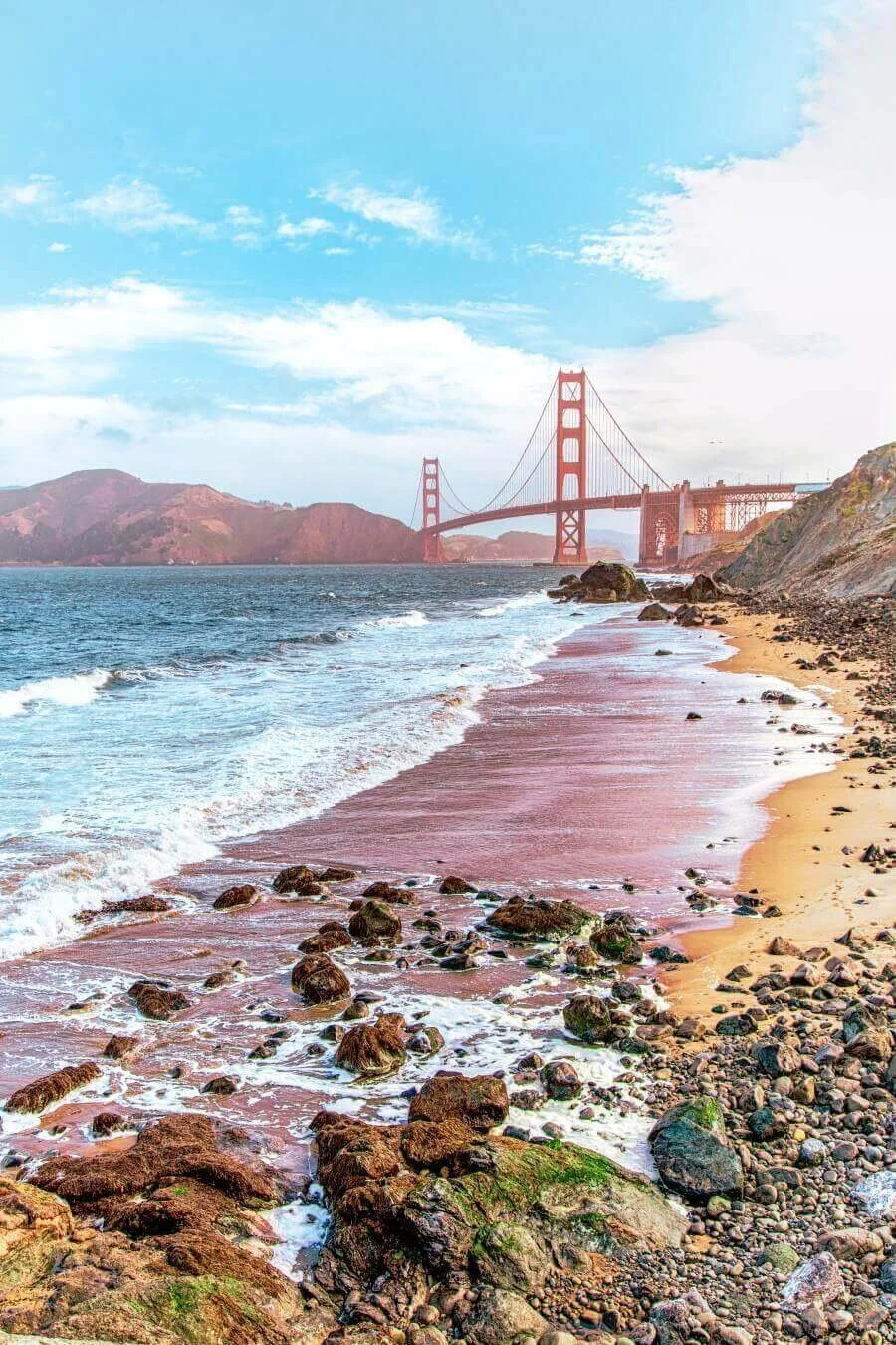
San Francisco
In case you didn’t know, San Francisco is a must-see city teeming with amazing restaurants, breweries, art, music, museums and more. With so many amazing options, it’s impossible to recommend just one! You can’t go wrong with lunch at Chubby Noodle, a beer at Cellarmaker Brewing, and a stroll around Golden Gate Park. If you’re spending the night in the city and it happens to be a Thursday, check out NightLife at California Academy of Sciences. Every Thursday from 6-10 pm, the museum opens its doors for a party with a different theme each week. This 21+ event features two house DJs, a bar, and access to almost all of the exhibits, including the rainforest room, where you can walk through a mock-ecosystem filled with reptiles and butterflies.
Head 30 miles south of San Francisco on HWY 1 to Half Moon Bay. Tucked away behind rolling hills, this oceanfront town features a wild, rugged coastline great for walking, bird-watching, fishing, and treating yourself to a seafood meal by the harbor.
Day 4: San Francisco to Yosemite National Park
Yosemite is a bucket list national park. Technically, it might be our country's 3rd national park, but its preservation sparked the whole idea of national parks. President Lincoln signed the Yosemite Land Grant on June 30, 1864, protecting the Mariposa Grove and Yosemite Valley, 8 years before Yellowstone became our first official national park and 26 years before Yosemite earned the distinction itself. From breathtaking views to a diverse population of wildlife, Yosemite National Park holds memories that will last a lifetime in its meadows, cliff faces, and waterfalls.
Top Stops:
Yosemite Falls
Discover the highest waterfall in North America and the sixth largest in the world. At 2,424 feet, Yosemite Falls is a major attraction in the park. It’s best viewed in late spring when snowmelt flows create an even more spectacular scene.
El Capitan
If you’ve seen the film Free Solo, where expert pro climber Alex Honnold ascends a massive rock face in Yosemite sans rope—well, that’s El Capitan. There are few vertical rock formations as challenging. At one time, the 3,000 foot “El Cap” was considered impossible to climb. Today, the most popular route to tackle is The Nose, which follows the rock’s huge projecting front. Even if you’re not a climber, this rock formation is an impressive sight.
Tuolumne Meadows
Right along the Tuolumne River, this beautiful meadow features wonderful wildflowers, lodgepole pine, and the edible dwarf bilberry. The area also offers day hikes and camping opportunities (the park service campground is open July through late-September).
Half Dome
This granite dome is Yosemite’s most popular rock formation. Rising 4,800 feet above the valley floor, if you’re feeling adventurous you can hike to the top with the help of bolted cables. Be prepared for a very strenuous 14-16-mile round trip hike.
Mariposa Grove of Giant Sequoias
Look up at one of the largest and oldest living things on Earth: the sequoia. Within Yosemite’s Mariposa Grove of 500 giant sequoias, you’ll discover trees more than 3,000 years old.

Day 5: Yosemite National Park to Sequoia and Kings Canyon National Parks
Sequoia National Forest and Park and Kings Canyon are home to endless views, calm lakes, misty waterfalls, and the biggest tree hugs around. The three different parks all have their own unique adventure spots, it’s only a matter of choosing what you’d like to see.
Top Stops:
General Sherman and Giant Forest
You’ll feel quite small walking among these massive trees. This trail features the largest tree in the world by volume; General Sherman clocks in at 1,385 tons. Check out the President Tree, the 3rd largest tree in the world by volume. The 2-mile Congress Trail takes you on a lovely stroll away from the crowds.
Crystal Cave
Purchase tickets for a tour of this beautiful marble cave at the Foothills Visitor Center. The cave is only open in the summer and it’s worth checking out for a unique opportunity to see stalactites and stalagmites right in the park.
Kings Canyon Scenic Byway
This scenic 50-mile drive offers gorgeous views of the river and mountain ranges with plenty of pit stops for photos.
General Grant Tree
General Grant Tree is the 2nd largest tree by volume in the world. It’s also the nation’s official Christmas tree. It would take one huge ladder to decorate! An easy, accessible trail also takes you to see the settler’s cabin and the Fallen Giant.
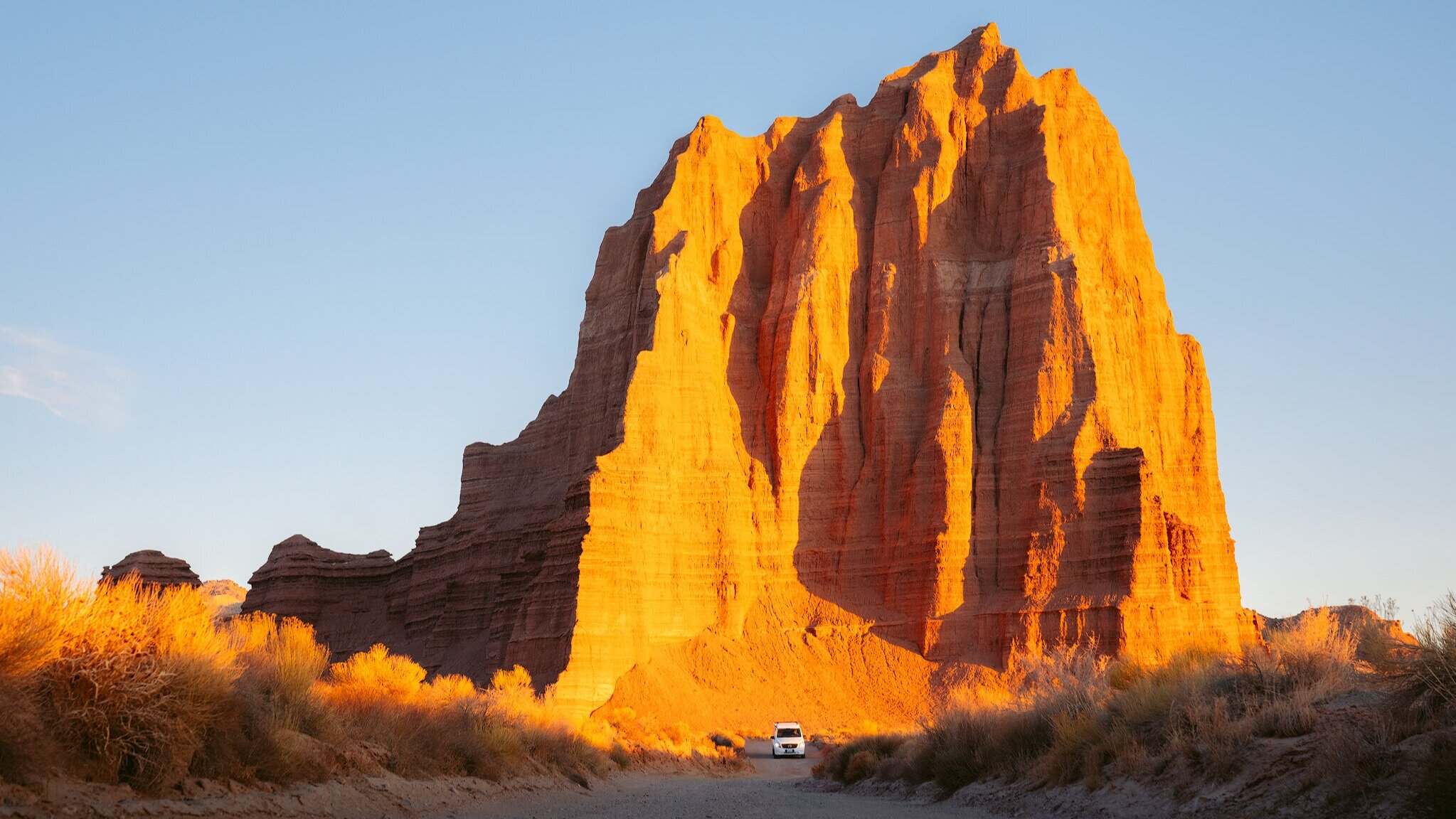
Day 6: Sequoia and Kings Canyon National Parks to Valley of Fire State Park, NV
Valley of Fire State Park is easily missed by most, but we highly recommend a stop here. Nevada’s first state park, the red, pink, and orange hues of the rock formations (particularly in bright sunlight) appear to be on fire, giving the park its name. There are tons of off-grid camping within minutes of the park, and with easy access to potable water, compressed air, and trash services, it makes for a relaxing time in the Nevada desert. It’s quite a trek from Sequoia and Kings Canyon. However, there are major cities to stop in and rest if need be. You’ll pass through Las Vegas, just 45 miles southwest of the park.
Top Stops:
Mouse’s Tank Road
This is the main road through the park, with stellar views around every turn.
The Beehives
These strange-looking sandstone formations can be seen in just a few minutes driving Mouse’s Tank Road. Grab your camera, get out of your car, and climb to the top of the highest dome for excellent views of Valley of Fire State Park.
Atlatl Rock
Climb the staircase at Atlatl Rock to check out the best display of petroglyphs in the park.
Pink Canyon
Pink Canyon, also called Pastel Canyon, is a fantastic, uncrowded stop. It’s unmarked, and parking is limited to just a few cars (GPS coordinates: 36°28’47” N 114°31’36” W). From the parking area, head east into the canyon. Enjoy this short but very pretty walk through a pastel pink slot canyon.
The Fire Wave
This is one of the most gorgeous spots in Valley of Fire State Park. This easy, 1.5-mile round trip hike leads to white and red stripes of sandstone that create a surreal display.
White Domes
This 1.25-mile loop is the most challenging hike in the park, with a descent at the beginning and then a return climb to the parking lot. Even so, it’s not difficult. Explore the boulders along this narrow slot canyon.


Day 7: Valley of Fire State Park to North Rim of Grand Canyon National Park and Kaibab National Forest, AZ
If you’re visiting between May 15 and October 15, opt for a visit to the Grand Canyon’s North Rim (open for day use only until December 1 or weather permits). What many argue to be the better rim of the Grand Canyon, the North Rim offers up-close and personal views of the Canyon’s depths. In addition to the beautiful national park, Kaibab National Forest offers many hiking trails, off-grid camping, and East Rim views. Did we mention this part of the Grand Canyon is less trafficked than the South Rim?
Top Stops:
Point Imperial
At an elevation of 8,803 feet, Point Imperial is the highest overlook on the North Rim and its most iconic. The trip can easily take half a day, so make sure you pack a lunch and take advantage of the overlook’s picnic tables. While you’re there, look eastward for views of the junction of the Colorado River and the Little Colorado River, as well as the Painted Desert. You’ll also see Marble Canyon, which opens dramatically into a view of the gaping Grand Canyon.
Cape Royal
Cape Royal is the southernmost vantage point on the North Rim. At an elevation of 8,000 feet, it offers the closest thing to a panoramic view of the Grand Canyon, which makes it incredibly fantastic at sunset. The Canyon occupies 270 degrees of the horizon. Keep your eyes peeled for the famous Desert View Watchtower on the South Rim.
Day 8: North Rim of Grand Canyon National Park to Zion National Park, UT
Utah’s first national park, Zion National Park, is a spectacular sight, and there’s no question why. Steep canyon walls and the winding Virgin River create a breathtaking scene. Fall is an especially lovely time in Zion National Park with cooler temps and the changing colors of the Cottonwoods—but honestly, any time of year is superb.
Top Stops:
The Narrows
Ever hiked through the middle of a river flowing through a slot canyon? Now’s your chance! As its name suggests, this is the narrowest section of Zion Canyon. Hike a mile or two upstream or spend the entire day wading through the canyon. For a full-day adventure, go as far as Big Spring, a strenuous, 10-mile round trip hike. The water is typically knee deep, but levels fluctuate depending on the time of year. Make sure you educate yourself on current conditions and avoid this hike when flash floods are a risk.
Angels Landing
For the brave, we recommend the jaw-dropping hike up Angels Landing. It’s a strenuous one, about 5 miles round trip with 1,500 feet of elevation gain and very steep drop offs on both sides of the trail. The last section is a narrow scramble with the assistance of bolted cables. The views on the summit are incredible, but this hike isn’t for the faint-hearted.
Lower, Middle & Upper Emerald Pools
This is a great hike if you’re looking for an easy, short, accessible option. The first .6 miles is a paved trail that leads to Lower Emerald Pool. Add on Middle and Upper Emerald pools for a 2.5-mile round trip trek. Keep your ears open! The Emerald Pools are a great place to hear the “songs” of the frogs that call Zion home.
Court of the Patriarchs
Court of the Patriarchs is considered the shortest trail in the park. It’s more of a stroll than a hike. You’ll ascend about 40 feet to a short rise in the bottom of Zion Canyon, just high enough to be treated to a view of the surrounding mountains. The Patriarchs are three neighboring sandstone peaks on the west side of the canyon. Each is named after biblical fathers: Abraham, Isaac and Jacob.


Day 9: Zion National Park to Bryce Canyon National Park
Not far from Zion National Park, Bryce Canyon National Park features bright orange and red spires that will make you feel like you’ve landed on another planet. Called hoodoos, these irregular columns of rock exist on every continent, but Bryce Canyon boasts the largest concentration found anywhere on Earth.
Top Stops:
Stargazing
See the Milky Way at Bryce Canyon. The park features one of the darkest night skies in the country. Sunset Point and Inspiration Point are excellent stargazing locations with nearby parking lots. You can join one of the ranger-led astronomy talks for a chance to view the night sky through one of the park’s telescopes.
Queen’s Garden/Navajo Loop
The Queen's Garden/Navajo Loop is the most popular hike in Bryce Canyon National Park, traversing through some of the most stunning sections of the park. Although it may be crowded at certain times of year (we’re looking at you, summer), it’s a must-do in the park. Go early to beat the crowds. The hike features outstanding views from the rim, descends along ridges into the canyon, and meanders among towering hoodoos. It’s a 2.9-mile loop best hiked clockwise.
Guided Trail Rides
Experience Bryce Canyon by horseback! The unique perspective from the saddle is a fun change of pace. Canyon Trail Rides, the park's concessioner, offers 2-hour ($75 per person) and 3-hour ($100 per person) guided horse and mule rides into the Bryce Amphitheater along a dedicated horse trail and the Peek-a-boo Loop Trail. Guided trail rides typically run April through October, depending on weather.
Day 10: Bryce Canyon National Park to Manti-La Sal National Forest
Manti-La Sal National Forest stretches across a large portion of Utah. It’s a great place to get your adventure on. With everything from whitewater rafting to ATV rides, this national forest provides an unforgettable time.
Top Stops:
Huntington and Eccles Canyons National Scenic Byway
Whatever the season, the views are breathtaking on the Huntington and Eccles Canyons National Scenic Byway. It’s a favorite for fishing, hiking, and camping. The route is rich with the history of mining in Utah’s coal country, with views of a coal-fired power plant and an operating mine along the way.
9,500-year-old Mammoth Discovery Site
Scientists believe at the end of the Ice Age as the climate was becoming drier and warmer, this male mammoth retreated to the colder mountain setting in search of food. Preserved intestinal contents show that he was subsisting on a meager diet of fir needles. Slowed by age and arthritis, the old bull died near the summit of Huntington Canyon. It may have been one of the last of its kind.


Day 11: Manti-La Sal National Forest to Albion Basin
Albion Basin is home to beautiful hikes, mountain biking, and ideal places to sit and watch the sunset. Alta, which is the nearby town, offers a ski resort, grocery stores, restaurants, and shops.
Top Stops:
Albion Basin Campground
At an elevation of 9,500 feet, this lovely campground is set among shady white pines and aspens. The basin hosts the Wasatch Wildflower Festival every summer with guided nature walks to view and identify local flora.
Cecret Lake
The trail to Cecret Lake begins right from the Albion Basin Campground and offers amazing views of the upper Albion Basin. It’s a short 1-mile hike to the lake through fields of wildflowers and abundant wildlife. You may even spot deer, moose or mountain goats on your journey.
Day 12: Albion Basin to Bruneau Dunes State Park, ID
Bruneau Dunes State Park is an incredible place to stop and see the tallest standing Sand Dune in North America, and a great time to break away from the trails and lakes to sled down the soft sand of Bruneau Dunes. This is a little longer drive, so stopping at Sawtooth National Recreation Area on the way is a great idea if you need to stretch those legs sooner than later. And if Boise, ID is a destination in mind, it’s only an hour from Bruneau Dunes State Park.
Top Stops:
Explore the Dunes
Hike the dunes or rent a sandboard from the Visitor Center. With one of the longest camping seasons in the Idaho Parks system, Bruneau Dunes State Park is a great launching pad to see what the dunes have to offer. Camping options are available throughout the year. Keep in mind off-road vehicles are only permitted on the main road of the park.
Fishing
Fish for bluegill in the lakes at the foot of the dunes.
Bruneau Dunes Observatory
Gaze at the night sky through the observatory’s collection of telescopes. The observatory is open to the public from early-April through mid-October on Friday and Saturday nights only, weather permitting.
Day 13: Bruneau Dunes State Park to Granite, OR
The town of Granite was once a major gold mining town, leaving us so much history to explore near the beautiful Umatilla National Forest. The area offers several gorgeous hikes, mountain biking trails, snowmobiling, and lakes to sit back and relax as your trip nears its end.
Top Stops:
Explore the Mine
After the discovery of gold on Independence Day in 1862 the town boomed for several decades, but by 1960 only three residents remained. Today, about 40 people call Granite home. Explore the old mining community and tour buildings from a bygone era. Granite is also a great jumping off point to visit the Fremont Powerhouse, Olive Lake, or the North Fork of the John Day River Trail.
Olive Lake
Nestled high up in the Blue Mountains of Eastern Oregon, this popular lake and campground is only 8 miles west of the historic Fremont Powerhouse and 12 miles west of the old mining town of Granite.
Elkhorn Crest Trail
This is a fantastic 23-mile single-track trail that hugs a high route through the Elkhorn Mountains. Along the way, you’ll see several magnificent peaks including Gunsight Peak, Rock Creek Butte, Angell Peak, Lees Peak, Rock Creek Butte, and Elkhorn Peak.


Day 14: Granite to Peace Vans, Seattle
Return to your home base after an incredible two weeks exploring the American Southwest. We hope you’ve made lifelong memories—and have great stories and photos to share!